


Forensic Palynology
Geoarchaeology
Publications
Research
Contact Paleo-Forge
Coastal Wetlands of the World
Geology, Ecology, Distribution & Applications
David B. Scott
Jennifer Frail-Gauthier
Petra J. Mudie
Cambridge University Press
ISBN: 9781107628250
May 2014
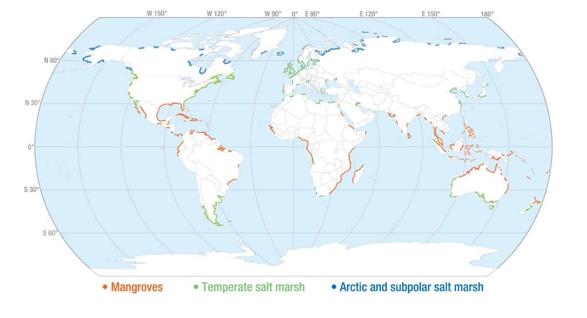
- Presents an integrated approach to wetlands combining geology and ecology, and including both salt marshes and mangrove forests
- Provides case histories from all continents except Antarctica, richly illustrated with images from real field studies, which are also accessible online in colour where available
- Explains the applications of wetlands studies to other fields such as pre-historical impacts of coastline changes, development of crops amidst shrinking global water resources, and conducting wetlands mesocosm experiments
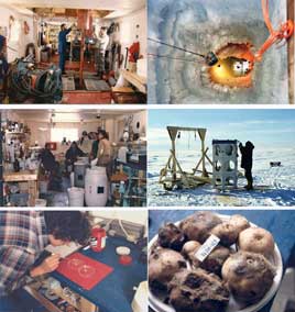
Canadian Ice Island photos
Discoveries from a “Ship of Ice” (1.2MB PDF)
Peta J. Mudie and H. Ruth Jackson
Voyage of Discovery: Commemorative Book on the Scientific Accomplishments of the Bedford Institute of Oceanography 50th Anniversary: 1962-2012
BIO-Oceans Association 2014
SUMMARY
It is probably true to say that The Ice Island Program was the most amazing Voyage of Discovery to be undertaken by Bedford Institute of Oceanography. Led by Drs Ruth Jackson and Peta Mudie at the Geological Survey of Canada Atlantic, the goal of the 1980s Program was to occupy a large semi-permanent ice island as a platform for the first oceanographic and geoscientific studies of Canada’s packice-covered Polar Margin between Ellesmere Island and Beaufort Sea. At the program start, this region of Canada was still unmapped: it was not even known if there was a continental shelf offshore – let alone what biological or mineral resources it contained. For five years, 40 people in joint government-university funded programs measured oceanographic and ice conditions, mapped the underwater territory, and studied the evolution of Canada’s northernmost continental margin. A permanent camp was built to allow seismic and geophysical surveys, seabed and plankton sampling, toxic and radioactive chemical surveys, oceanography, meteorology, atmospheric sampling and ice strength studies. Technical achievements are construction of the first large, deep (44 m) holes through a floating ice island for piston coring, dredging and water sampling; collecting >200km of seismic reflection and bathymetry data; taking the first underwater photographs of the seafloor beneath the permanent packice; and collecting sediment and biological samples from this hitherto unexplored part of Canada – in the coldest sector of the Arctic Ocean. Scientific highlights include discovery of previously unknown Arctic glass sponge reefs, records of recent Canadian Arctic Ocean warming, tracing of radioactivity, pesticide and dust fallout from Britain, Ukrainia and China to the Canadian Polar margin, and mapping of bedrock that contains large petroleum reservoirs. The new maps also extend Canada’s continental margin 300% further northwards. The hands-on training and engineering experience from the Ice Island Program now puts Canada on the forefront of ongoing UNCLOS (United Nations Law of the Sea) survey work, and the ice strength studies are used to design new hulls of Coast Guard and commercial Arctic icebreakers
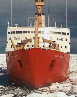
The Louis S. St. Laurent at 80N
Arctic catastrophes: sea ice changes and impacts in the Eastern Arctic during the past 4,000 years poster presented at the Conference on Rapid Landscape Change and Human Response in the Arctic and Sub-Arctic, June 15-17, 2005, Yukon College, Whitehorse, Yukon
(1200 x 900 pixels 464K JPG)
(2400 x 1800 pixels 1 MB JPG) or (884K PPT)
Mudie, P.J., Levac, E. , and Rochon, A.
For more informative research on climate change in the Arctic see Paleoceanography.
Paleoceanography :: Forensic Palynology :: Geoarchaeology
Research :: Publications :: Contact Paleo-Forge
Sealevel
Photos: P.J. Mudie, All content copyright © Paleo-Forge, 2004-15